
I was born in a little Michigan town on the beautiful crystal-clear St. Clair River that forms part of the border between the US and Canada and joins with the Detroit River system on its way from Lake Huron to Lake Erie.
Although I lived about 4 miles out of town, the river was a part of our daily lives. Every time we went into town, the river’s presence was both felt and seen.
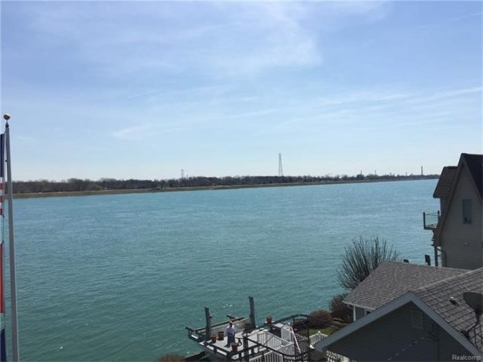
As the river flows past town it is nearly a mile wide and the current is a quick 8 miles per hour – you have to be a strong swimmer to swim against that current and a swim across the river puts you about a mile and a half down stream when you reach the other side. A boat accompaniment is a must if you want to get home before dark.
After the south end of town, the river splits into the North, Middle and South Channels. The North and Middle Channels are prime recreational waterways while the South Channel carries the lake freight traffic with ships up to 800 feet long carrying everything from grain to iron ore to industrial ports along the way.
The river turns westward as in diverges into the 3 channels and there are many islands along the bend that stop the winter ice that breaks up from the tidal action in Lake Huron and floats downriver, creating ice jams that pile up to staggering heights and backs up for miles. On calm winter days the river freezes over, but the floating lake ice breaks the river ice adding to the pile-up.
The ice jam often reaches heights of 25 to 50 feet, and when the spring thaw starts melting the ice, flooding in the low-lying riverfront homes is common. When the ice starts to move it takes anything in its path with it. Many dock builders rejoice in the repairs necessary after the ice is gone. They stay busy until the next winter and then the cycle begins again.
Just around the bend in the North Channel is Harsens’s Island, the only island in the river system that is served by an automobile ferry. The water west of the ice jam is calm and freezes over quite thick and usually requires a Coast Guard ice-breaker to open the route to the island.
Further downstream is Anchor Bay where the ice reaches depths of 4 feet or more and is thick enough for automobiles to drive on – except where the gas bubbles make for thin ice that will break under foot traffic. Quite often people lose their vehicles and don’t get them back until spring.
Anchor Bay is noted for its ice fishing and the ice shanties in deep winter out number the homes, more than doubling the local population and bringing much needed revenue to local merchants.
The river, as noted earlier, freezes and ferry service is interrupted between the US and Canada, causing people to trust their luck to crossing on the ice on foot. There are many voids in the river ice and to further complicate matters, the river emits gasses that bubble up under the ice leaving paper thin ice that won’t withstand a person’s weight, making the trek precarious at best. Its not uncommon to lose one or more people a year through thin ice, not to be found again until the ice is gone.
The high school in town was only a few blocks from the river and during exams in June, the kids always use the time between exams to open the summer swimming season. The river never gets above 68° in midsummer, so the beginning of the season makes for rather short dips until one gets used to the cold.
I moved to Florida 50 years ago to get out of the Michigan cold weather, and I don’t miss it a bit, but I do miss the river. On calm nights when the air was thin we could hear the freighters chugging along and on foggy days, when visibility is reduced to a matter of feet, the mixture of fog horns creates a pleasant cacophony that can be heard for miles. I live now just a few miles from Port Everglades and once in a while I hear the horns and whistles of the cruise ships and it takes me back to my younger days.
I rarely get the chance to return to Michigan for visits, but when I do go, I make sure to visit the St. Clair River.
Ice beginning to fill the river. By mid-winter the ice will pile up to staggering heights.
A much nicer view of the St. Clair River looking at sparsely populated Dickinson Island.